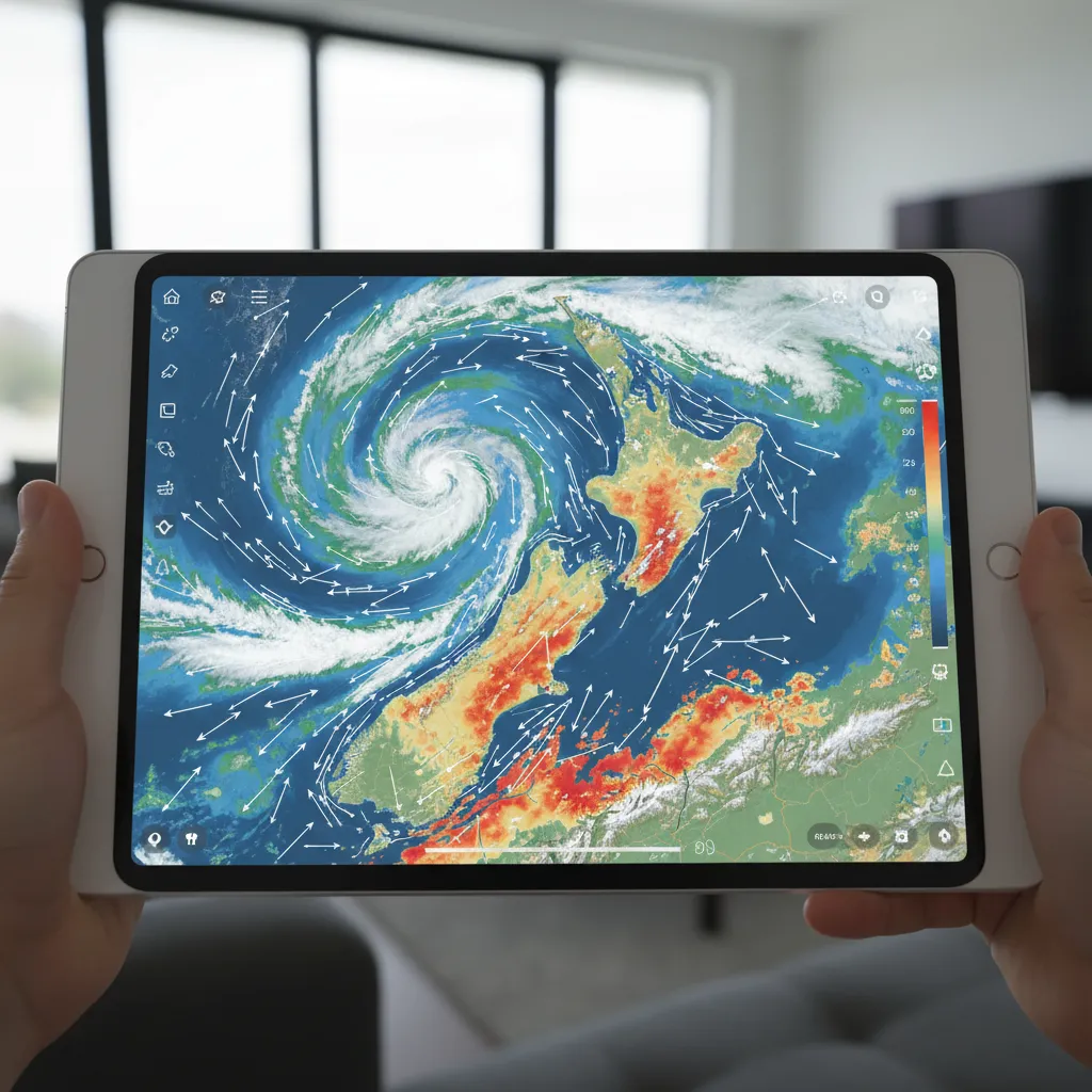
A cloud cover forecast for NZ stargazing requires analyzing multi-layered meteorological data, specifically distinguishing between high cirrus clouds and low stratus layers. For the most accurate prediction, stargazers should combine the official MetService rain radar with specialized astronomical weather tools like Clear Outside or Windy.com to identify localized clear windows within New Zealand’s dynamic maritime climate.
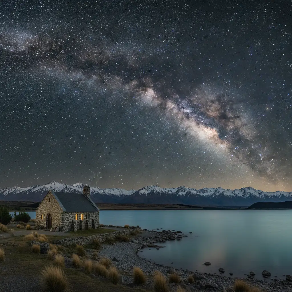
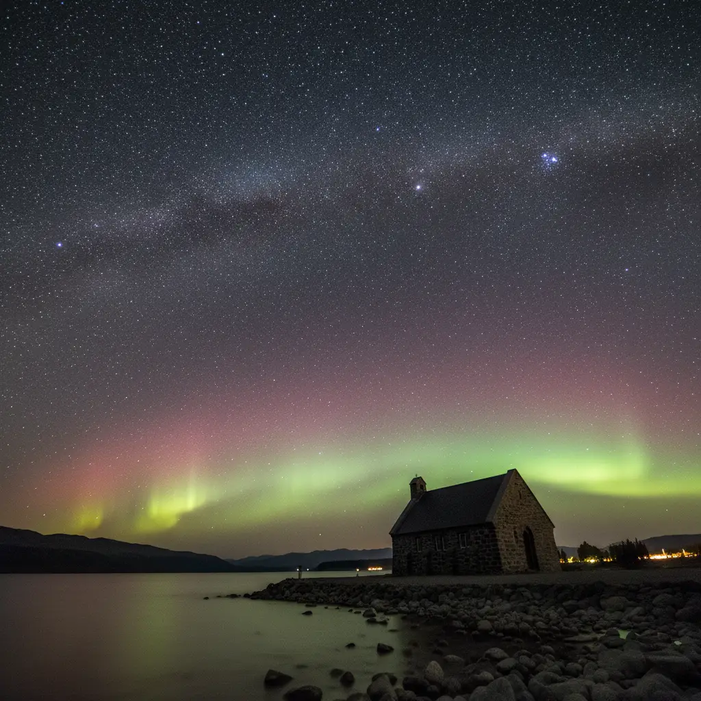
New Zealand is widely regarded as one of the premier locations on Earth for astrophotography and celestial observation. Home to the Aoraki Mackenzie International Dark Sky Reserve and the Great Barrier Island Dark Sky Sanctuary, the country offers unrivaled views of the Milky Way, the Magellanic Clouds, and the Aurora Australis. However, the nation’s long, narrow geography and maritime climate mean that weather conditions can change rapidly. Mastering the art of predicting cloud cover is the single most important skill for any dark sky tourist or photographer visiting Aotearoa.
How do I interpret MetService Cloud Forecasts for Stargazing?
The MetService is New Zealand’s national weather authority and should be your primary baseline for any weather-related planning. However, a standard “partly cloudy” icon on a general forecast is often insufficient for the specific needs of an astronomer or night-sky tourist. To truly utilize a cloud cover forecast for NZ stargazing, you must dig deeper into the specific data layers provided by the service.
Distinguishing Between High and Low Cloud
Not all clouds are created equal when it comes to viewing the cosmos. MetService provides detailed satellite imagery that helps distinguish between cloud layers:
- Low Cloud (Stratus/Cumulus): These are the stargazing killers. Low clouds are dense, block all visibility of stars, and reflect city lights (if near urban areas), increasing light pollution. If the forecast predicts low cloud or fog, your chances of a successful viewing are near zero.
- High Cloud (Cirrus): These are wispy, ice-crystal clouds found at high altitudes. While not ideal for deep-sky astrophotography, high clouds often allow bright stars and planets to shine through. For a casual observer, a night with high cloud can still yield a beautiful experience, often creating a halo effect around the moon.
Using the Rain Radar and Satellite Imagery
Static forecasts are often outdated by the time you read them. The most effective method for predicting clear skies is to learn how to read the live Rain Radar and Infrared Satellite maps available on the MetService website and app.
The Infrared Satellite map is particularly useful at night. Since visible satellite imagery requires sunlight, it goes black after sunset. Infrared imagery, however, detects the temperature of the cloud tops. Brighter white areas indicate high, cold cloud tops (often associated with storm fronts), while greyer areas indicate lower, warmer clouds. By animating these maps, you can track the trajectory of cloud masses and predict exactly when a gap might open up over your location in the Mackenzie Basin or Wairarapa.
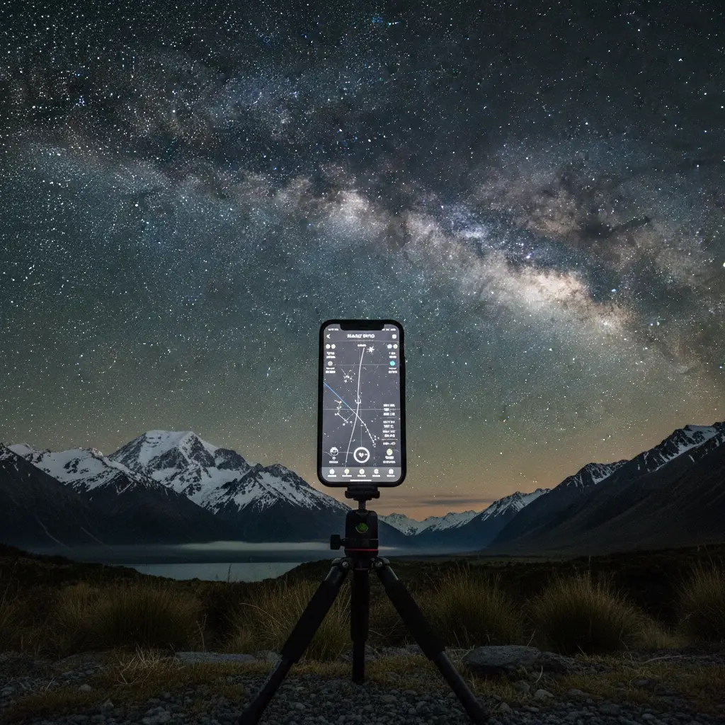
What are the Top Apps for Light Pollution Maps and Stargazing?
While MetService provides the raw meteorological data, dedicated third-party applications are essential for synthesizing this information into actionable stargazing intelligence. To secure the best view of the Southern Cross, you need tools that overlay cloud data with light pollution maps.
1. Clear Outside (The Astronomer’s Choice)
Developed by First Light Optics, Clear Outside is arguably the most granular cloud cover forecast tool available for NZ stargazing. It breaks down cloud cover into three distinct percentages: Low, Medium, and High.
For example, a forecast might read: Low (0%), Medium (0%), High (100%). A novice using a standard weather app might see “Cloudy” and stay inside. An expert using Clear Outside knows that 100% high cloud might still allow for some visibility, or that the high cloud is passing quickly. The app also provides essential data on lunar phases, ensuring you don’t book a dark sky tour during a Full Moon when the sky is naturally washed out.
2. Windy.com (The Visualizer)
Windy is an incredibly powerful visualization tool. It allows you to toggle different weather models (ECMWF, GFS, ICON) to see if they agree on the forecast. If all three models predict clear skies over Mount Cook, you can proceed with high confidence. Windy also offers a “Cloud Base” layer, which is critical for those hiking to higher elevations. If the cloud base is at 1,000 meters and you are observing from a hut at 1,500 meters, you may be above the cloud layer entirely—a phenomenon known as an inversion.
3. LightPollutionMap.info
Finding a gap in the clouds is useless if you are standing under a streetlamp. This web-based tool (and app) uses VIIRS satellite data to show light radiance. In New Zealand, you will notice the North Island has pockets of light pollution around Auckland, Hamilton, and Wellington. However, the South Island, particularly the central region, is a vast void of darkness. Use this map to find “Bortle Class 1 or 2” zones—the darkest skies measurable—which are surprisingly accessible in NZ.
The Risk-Averse Planner’s Guide to Weather Windows
Planning a trip to New Zealand specifically for stargazing involves significant financial investment. To mitigate the risk of cloudy nights, you must adopt a strategic approach to your itinerary. The “she’ll be right” attitude is not sufficient for astrotourism.
Understanding the “Nor’wester” Arch
New Zealand’s topography heavily influences cloud patterns. The Southern Alps act as a massive barrier to prevailing westerly winds. This creates a phenomenon known as the Föhn effect.
When winds blow from the west, the West Coast (Franz Josef, Fox Glacier) experiences heavy rain and thick cloud cover. However, as the air rises over the Alps and descends into the Canterbury Plains and Mackenzie Basin (Tekapo/Twizel), it warms and dries out. This often results in the “Nor’west Arch”—a distinct arch of cloud to the west, but crystal clear skies overhead and to the east. Understanding this localized weather pattern can save your trip; when the forecast looks bad for the West Coast, the East Coast might be offering world-class transparency.
The 3-Night Rule
Never book a single night in a dark sky reserve and expect a guarantee. The golden rule for NZ stargazing is the 3-Night Stay. Statistically, in the Mackenzie Basin, staying three nights gives you a greater than 90% probability of having at least one night with acceptable observing conditions. If you are moving to a new hotel every night, you are constantly rolling the dice against the weather systems.
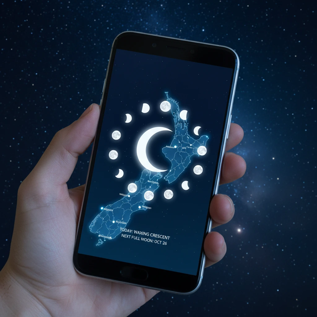
Moon Phase Planning
Cloud cover is not the only obstruction; the Moon is the biggest source of natural light pollution. Always consult a lunar calendar before booking. The best time for stargazing is during the New Moon phase (0% illumination) or the Third Quarter (when the moon rises very late at night). Attempting to see the Milky Way core during a Full Moon is futile, regardless of how clear the cloud cover forecast is.
The Matariki Factor: Winter Stargazing
Matariki (the Māori New Year) is marked by the rising of the Pleiades star cluster in mid-winter (June/July). This is culturally and astronomically one of the most significant times to visit New Zealand.
Pros of Winter Stargazing:
Winter offers the longest nights. In June, true darkness can begin as early as 6:30 PM and last until 6:30 AM, giving you a massive window of opportunity. Furthermore, cold winter air holds less moisture than warm summer air, leading to “better seeing” (less atmospheric turbulence) and sharper stars.
Cons of Winter Stargazing:
It is incredibly cold. Temperatures in the Mackenzie Basin can drop to -10°C (14°F). Roads can be icy, and weather systems can be more aggressive. However, the visual reward of the galactic core rising directly overhead in winter makes the physical discomfort worthwhile for enthusiasts.
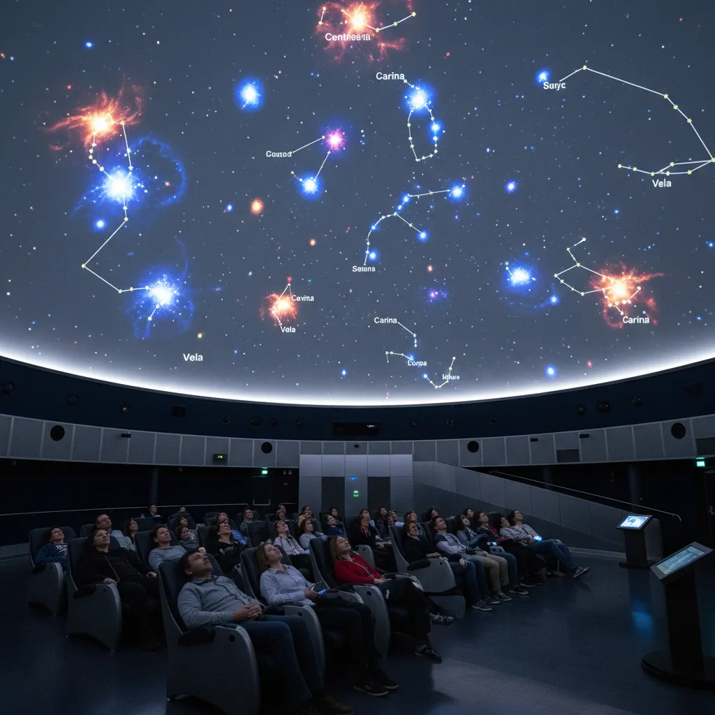
What are the Indoor Alternatives if it Rains?
Despite your best efforts analyzing the cloud cover forecast nz stargazing data, Mother Nature sometimes wins. If you find yourself in the middle of a multi-day storm, New Zealand offers world-class indoor astronomical experiences that ensure your trip remains educational and awe-inspiring.
Dark Sky Project (Lake Tekapo)
The Dark Sky Project has invested heavily in the “Dark Sky Experience,” an indoor, multimedia attraction. It focuses on Māori astronomy (Tātai Aroraki) and the science of the solar system. While it doesn’t replace the real sky, it provides profound cultural context that enhances your appreciation of the stars when they do appear.
Space Place at Carter Observatory (Wellington)
Located at the top of the Cable Car in Wellington, this is New Zealand’s national observatory. It features a full-dome digital planetarium. If the capital city is clouded over (which is common due to its position in the wind tunnel of the Cook Strait), the planetarium shows offer a guaranteed view of the southern skies, complete with live narration from astronomers.
Horizon Tours (Dunedin)
While primarily an outdoor operator, many southern tours have adapted to the climate by offering “Southern Lights” presentations and astrophotography workshops that can be conducted indoors or under partial cover, teaching the technical skills of camera setup even if the sky isn’t cooperating.
People Also Ask
What is the best month for stargazing in New Zealand?
Winter months (June to August) are generally considered the best for stargazing in New Zealand. These months offer the longest nights and the clearest, crispest air. It is also the time when the core of the Milky Way is most visible, and the Matariki cluster rises. However, prepare for sub-zero temperatures.
Can you see the Milky Way with the naked eye in NZ?
Yes, absolutely. In New Zealand’s Dark Sky Reserves and rural areas, the Milky Way is clearly visible to the naked eye as a bright, textured band of light stretching across the sky. It is so bright in these areas that it can actually cast a faint shadow on the ground.
How accurate are cloud cover forecasts?
Cloud cover forecasts are generally accurate within a 24-hour window but can be volatile in New Zealand due to the island nation’s fast-moving weather systems. It is recommended to check the forecast multiple times a day and rely on real-time satellite imagery rather than static predictions made days in advance.
Where is the darkest sky in New Zealand?
The Aoraki Mackenzie International Dark Sky Reserve (South Island) and Great Barrier Island (North Island) are certified International Dark Sky Sanctuaries/Reserves. Stewart Island (Rakiura) is also an International Dark Sky Sanctuary and offers some of the darkest, most pristine skies in the world.
What does 50% cloud cover mean for stargazing?
50% cloud cover implies that half the sky is obscured. For stargazing, the location of this cloud matters. If the 50% is on the horizon, the zenith (overhead) might be clear. However, if it is 50% high cirrus cloud spread thinly across the whole sky, transparency will be poor, reducing the visibility of faint stars.
Is the Aurora Australis visible all year round?
The Southern Lights (Aurora Australis) can technically occur at any time of year, but they are only visible when the sky is dark. Therefore, winter (March to September) offers the best chances due to longer nights. Visibility also depends on solar activity, not just the season.