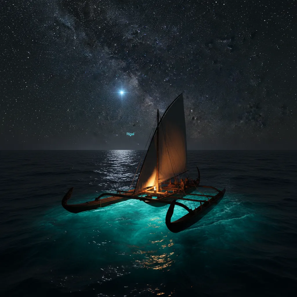
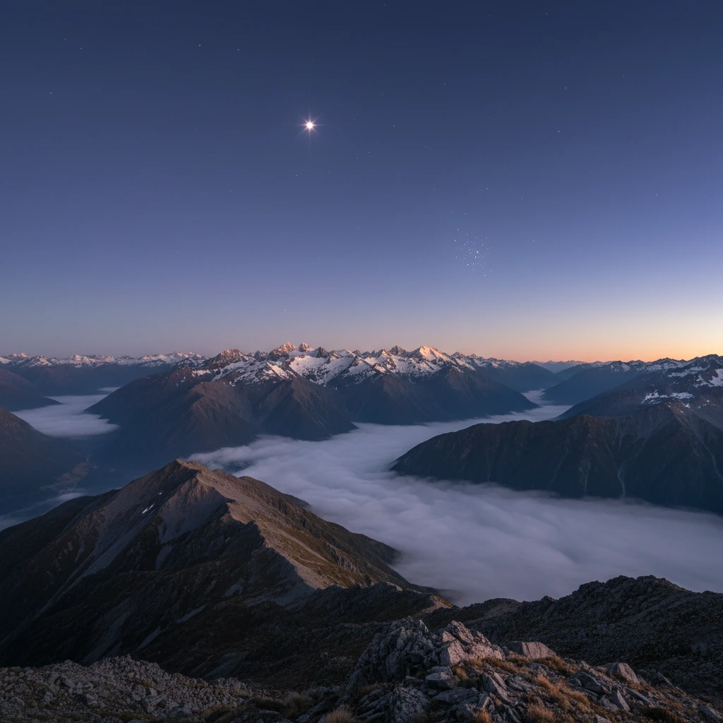
Puanga (Rigel) serves as a critical celestial beacon in waka navigation, acting as a primary orientation star within the constellation of Orion. For Polynesian navigators, Puanga helps determine latitude and acts as a seasonal marker, guiding waka hourua (double-hulled canoes) across the vast Pacific Ocean by indicating cardinal directions and signaling weather transitions essential for safe voyaging.
The art of wayfinding is not merely about moving from one landmass to another; it is a spiritual and scientific dialogue with the cosmos. In the rich tapestry of Māori astronomy and Pacific navigation, few stars shine as brightly—both literally and metaphorically—as Puanga. Known to the western world as Rigel, this blue-white supergiant forms the left foot of Orion (The Pot) and has guided navigators for centuries.
Understanding Puanga navigation waka traditions unlocks a deeper appreciation for the sophistication of ancestral knowledge. This guide explores how ancient captains utilized this celestial giant to traverse the largest ocean on Earth without modern instruments.
What is the Role of Puanga in Waka Navigation?
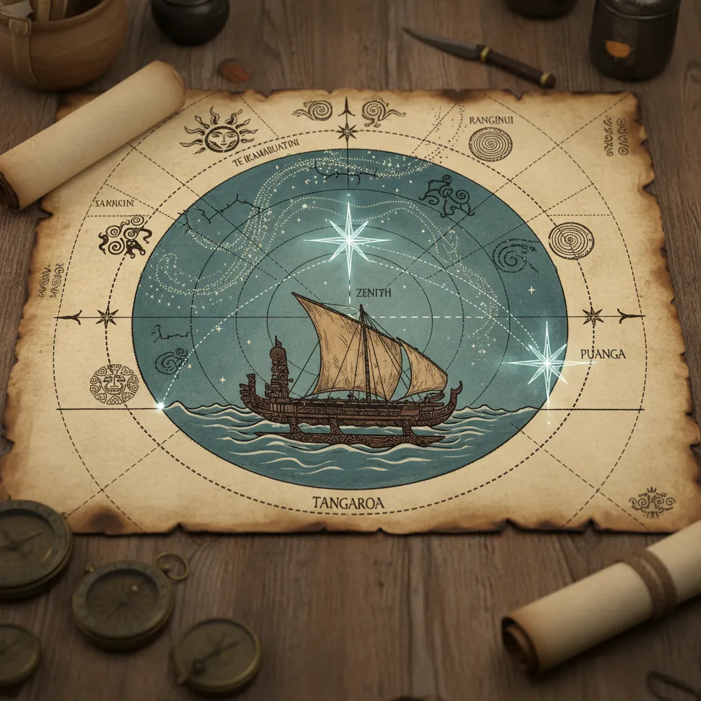
To understand the specific application of Puanga in navigation, one must first understand the “Star Compass” used by Polynesian wayfinders. The horizon is divided into houses where stars rise and set. Puanga, being one of the brightest stars in the night sky (the seventh brightest, in fact), provides an unmistakable reference point.
In the context of Puanga navigation waka strategies, this star is often used as a “steering star.” Because it rises in the East-Southeast and sets in the West-Southwest (depending on the observer’s latitude), it provides a consistent arc that navigators can follow. When a navigator holds their course by keeping Puanga at a specific angle to the canoe’s prow, they maintain a bearing relative to the earth’s rotation.
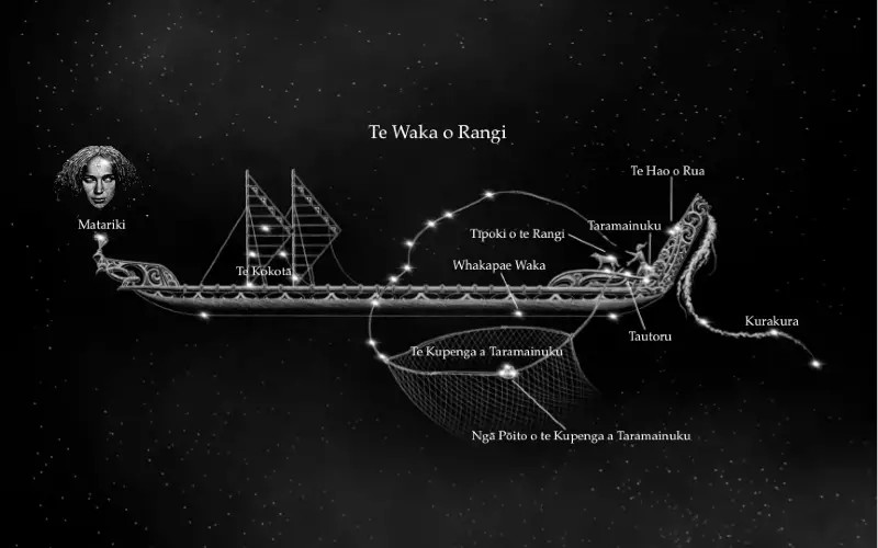
Furthermore, Puanga acts as a precursor to other significant constellations. Its position relative to Matariki (the Pleiades) and Tautoru (Orion’s Belt) creates a celestial map. Navigators memorize the sequence of these stars rising; when Puanga breaches the horizon, they know exactly which other navigational stars will follow, allowing for continuous course correction throughout the night.
Historical Use of Rigel in Ocean Voyaging
The history of Pacific migration is written in the stars. Long before magnetic compasses or GPS, ancestors used the stars as their highway. Rigel, or Puanga, was central to this because of its luminosity and distinct color. In the deep darkness of the open ocean, the blue-white intensity of Puanga cuts through atmospheric haze better than dimmer stars.
The Celestial Sphere concept
Ancient navigators conceptualized the sky as a dome surrounding the canoe. They understood that while the canoe appeared to be moving, in their mental model, the canoe was stationary, and the islands and stars moved toward them. In this framework, Puanga was a reliable friend. Historical accounts suggest that during the long voyages from Hawaiki to Aotearoa, Puanga was used to verify the waka’s heading during the winter months when the star is most prominent.
Unlike wandering planets, Puanga is a “fixed star.” Its declination does not change rapidly over human lifetimes. This reliability meant that the knowledge passed down from a grandfather to a grandson regarding Puanga’s path remained accurate, preserving the safety of the lineage.
Puanga as a Zenith Star and Latitude Marker
One of the most advanced techniques in celestial navigation is “Zenith Star” navigation. A star is considered a zenith star for a specific island or location if it passes directly overhead (90 degrees from the horizon) at that location. By knowing which star is the zenith star for a destination, a navigator can sail until that star is directly overhead, confirming they are at the correct latitude.
Puanga (Rigel) has a declination of approximately 8 degrees South. This means it passes directly overhead for islands situated near 8 degrees South latitude. This includes regions near Tuvalu, the northern Solomon Islands, and parts of Papua New Guinea—areas integral to the broader Polynesian expansion.
The Latitude Hook
While Puanga is not a zenith star for New Zealand (which lies roughly between 34 and 47 degrees South), it served as a vital “latitude hook” for voyagers returning north to the tropics. As a waka sails north from Aotearoa, Puanga climbs higher in the sky each night. Experienced navigators knew exactly how high Puanga should be above the horizon to indicate they had reached the latitude of the tropical islands. This technique allowed them to sail north until the star reached the correct altitude, then turn west or east to find their island target (a technique known as “running down the latitude”).
Seasonal Navigation Markers and the Maramataka
Navigation is not just about space; it is about time. The appearance of Puanga signals specific seasonal changes that dictate when it is safe to launch a waka. In the Maramataka (the Māori lunar calendar), the heliacal rising of stars marks the changing of seasons.
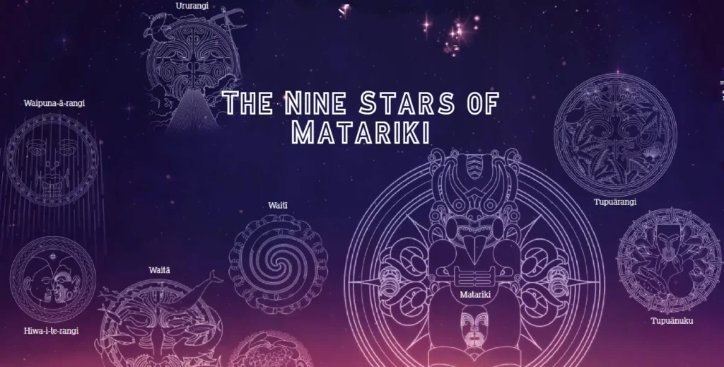
Puanga vs. Matariki: Regional Indicators
While Matariki is the most famous marker for the Māori New Year, in parts of the Far North and the West Coast of the South Island, Puanga is the primary signal. Geographically, mountains often obscure the low-rising Matariki in these regions, making the higher-rising Puanga the herald of the new year.
For navigators, the rising of Puanga in the pre-dawn sky (usually around June/July) signaled the arrival of winter. This was generally a time to cease long-distance voyaging due to rough seas and unpredictable storms. Conversely, as Puanga moved to the evening sky in summer, it signaled the voyaging season. Understanding this seasonality was a matter of life and death. A captain who ignored the position of Puanga and launched a deep-sea voyage at the wrong time of year risked the lives of everyone on board.
Reading the Water and Sky
The presence of Puanga also correlates with specific ocean conditions. Traditional knowledge holds that when Puanga “shimmers” or twinkles violently, it indicates high winds and atmospheric turbulence. A steady, clear light from Puanga predicts calm seas. Navigators would observe the star for several nights before departure to gauge the stability of the atmosphere, effectively using the star as a barometer.
Stories from Waka Hourua Captains
The revival of waka hourua voyaging in the late 20th century brought the practical application of Puanga navigation waka techniques back to life. Legends became lessons as modern captains relearned the old ways.
Reviving the Knowledge: Sir Hekenukumai Busby
The late Sir Hekenukumai Busby, a master waka builder and navigator, was instrumental in reviving this knowledge in Aotearoa. He often spoke of the “House of Puanga.” He taught his students that Puanga was not just a point of light, but an ancestor watching over the vessel. During the construction of the waka Te Aurere, the alignment of the hull was often checked against celestial markers to ensure it would cut through the water efficiently.
Busby recount stories of voyages where heavy cloud cover obscured most of the sky. In these moments, a brief break in the clouds revealing Puanga was enough to reorient the entire crew. The psychological boost of seeing such a powerful star cannot be overstated; it reassured the crew that their path remained true.
Modern Voyages using Ancient Stars
On recent voyages across the Pacific triangle (Hawaii, New Zealand, Rapa Nui), captains have relied on Puanga to cross the Intertropical Convergence Zone (the Doldrums). Here, the seas are confusing and winds die. Navigators use the high altitude of Puanga to maintain a northward or southward heading when ocean swells—usually a primary navigational aid—become chaotic and unreliable.
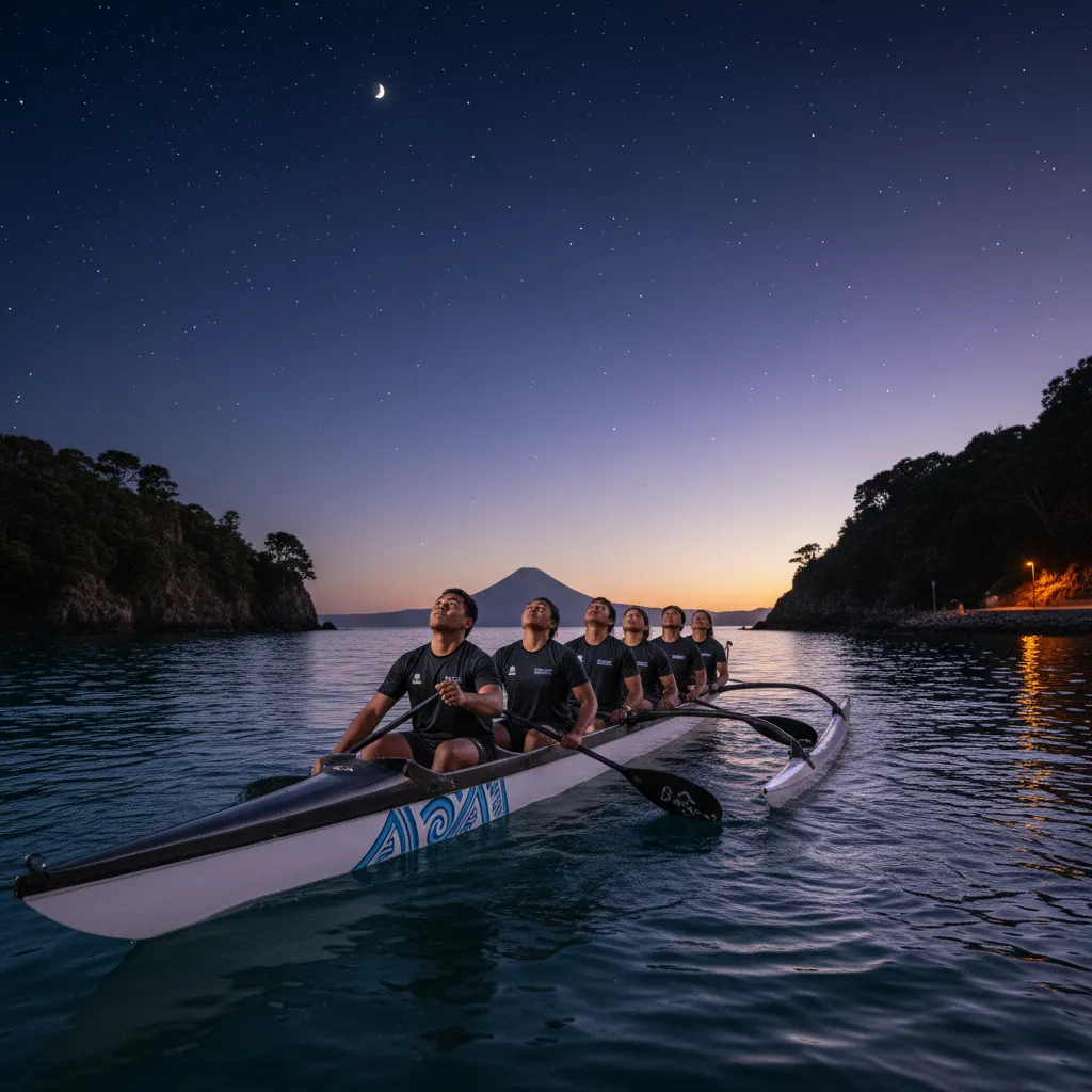
Modern Application in Waka Ama and Education
Today, the legacy of Puanga is kept alive not just in ocean voyaging, but in the sport of Waka Ama (outrigger canoeing) and cultural education programs. While Waka Ama is often a sprint or marathon sport within harbors, the cultural components of the training increasingly incorporate navigation.
Kaiako (teachers) use the story of Puanga to teach rangatahi (youth) about observation and patience. In training camps, paddlers are taught to identify Puanga to connect them with their environment. It transforms the sport from a purely physical exertion into a cultural practice.
Furthermore, planetariums and museums across New Zealand now feature “Puanga navigation” modules. These educational tools project the night sky as it would look from the deck of a waka, allowing students to practice identifying the star and measuring its altitude using their hands (a technique called “measuring the kavenga”). This democratization of knowledge ensures that the navigational significance of Puanga will not be lost to history again.
By integrating the study of Puanga navigation waka traditions into modern curriculum, we ensure that the next generation understands that their ancestors were some of the greatest scientists and explorers the world has ever seen.
Frequently Asked Questions
What is the difference between Puanga and Matariki in navigation?
While both are used for timing and seasonality, Matariki is a star cluster (Pleiades) and Puanga is a single bright star (Rigel). In navigation, Puanga is brighter and often easier to track as a steering star in the constellation of Orion, whereas Matariki is primarily a calendar marker for the New Year.
How do navigators use Puanga to find direction?
Navigators memorize the rising and setting points of Puanga on the horizon. By aligning the waka with Puanga’s position, or keeping it at a specific angle relative to the hull, they can maintain a consistent bearing (direction) even without a compass.
Is Puanga visible all year round in New Zealand?
No, Puanga is seasonal. It is most prominent in the winter sky (rising in the early morning in June/July) and is visible in the evening sky during summer. There are periods when it is too close to the sun to be seen, which also signaled changes in voyaging seasons.
Why is Puanga called a Zenith Star?
Puanga is a Zenith Star for latitudes around 8 degrees South. This means it passes directly overhead at those locations. Navigators used this property to determine when they had reached islands situated at that specific latitude.
Can Puanga predict the weather for sailing?
Yes, traditional navigators observe the light quality of Puanga. If the star is twinkling rapidly and appears colorful, it suggests turbulence and high winds (bad weather). A steady, clear light from Puanga predicts calm seas.
How is Puanga used in modern Waka Ama?
In modern Waka Ama, Puanga is used primarily for cultural education and connecting paddlers to the environment. It teaches orientation and observation skills, adding a layer of spiritual and historical depth to the physical sport.