An interactive night sky map tool is a digital application utilizing GPS and augmented reality to identify celestial bodies in real-time. For Matariki observers, these tools provide essential features like Māori constellation overlays, light pollution heat maps, and horizon alignment guides, ensuring precise location of the Pleiades cluster during the pre-dawn mid-winter rise.
As the Māori New Year dawns, the appearance of Matariki (the Pleiades) signals a time of remembrance, joy, and peace. However, locating this specific star cluster low on the horizon before sunrise can be challenging without technological assistance. Utilizing a robust interactive night sky map tool transforms this cultural experience from a guessing game into a precise astronomical event. Whether you are in the light-polluted center of Auckland or the dark sky sanctuary of Tekapo, modern digital tools bridge the gap between ancient navigation and modern technology.
What is an Interactive Night Sky Map Tool?
An interactive night sky map tool is more than just a static chart; it is a dynamic software solution often found in mobile applications or web-based platforms that simulates the celestial sphere based on your exact geolocation and time. Unlike traditional planispheres which require manual alignment and calculation, these digital tools utilize the magnetometer, accelerometer, and gyroscope within your device to create a 1:1 representation of the sky above you.
For those seeking to participate in Matariki celebrations, these tools are indispensable. The Matariki cluster is visible for a limited window in the pre-dawn sky during mid-winter (June/July in New Zealand). Because it sits relatively low on the northeastern horizon, it is easily obscured by terrain or confused with other clusters like Taurus (The Bull) or Orion’s Belt (Tautoru). An interactive tool eliminates this confusion by drawing lines between stars and labeling them instantly on your screen.

Real-Time AR View: The Future of Stargazing
The most critical feature for immediate identification of Matariki is the Augmented Reality (AR) view. This technology overlays digital information onto the real world through your phone’s camera lens.
How AR Enhances the Matariki Experience
When you point your device toward the northeastern horizon between 5:30 AM and 6:30 AM, the AR feature does the heavy lifting. It superimposes the star names directly over the points of light you see in the sky. If it is cloudy, the tool can “look through” the clouds, showing you exactly where Matariki would be rising, allowing you to orient yourself correctly for when the skies clear.
This feature is particularly useful for educational purposes. Parents and teachers can hold up a tablet, allowing a group to see exactly which star is Tupu-ā-nuku (connected to food from the ground) and which is Tupu-ā-rangi (connected to food from the sky), making the cultural narrative tangible and visual.
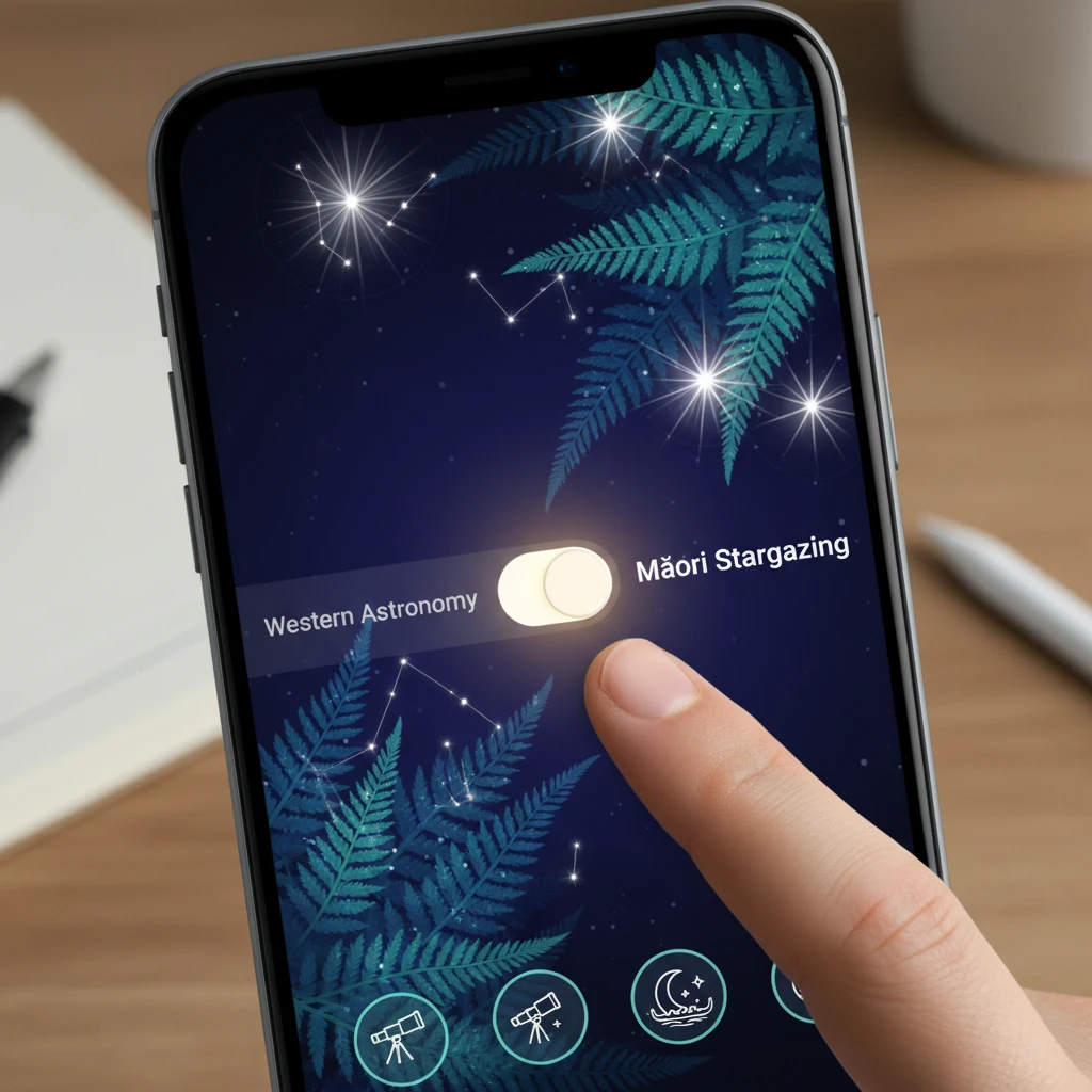
Bridging Worlds: Toggling Māori and Western Star Names
A standard astronomy app might label the cluster as “M45” or “The Pleiades,” listing stars like Alcyone, Maia, and Electra. While scientifically accurate, this does not serve the cultural intent of observing Matariki. The best interactive night sky map tools for the New Zealand market offer a dedicated setting to toggle between Western scientific nomenclature and Indigenous Māori astronomy (Tātai Arorangi).
Why Dual Naming Matters
Understanding the sky requires context. By toggling to the Māori setting, the constellation Orion becomes Tautoru, and the Milky Way becomes Te Ika-a-Māui (The Fish of Māui) or Te Waka-o-Tamarereti. This feature allows users to engage in a form of digital bilingualism, respecting the ancestral knowledge that used these stars for navigation and agriculture long before GPS existed.
When selecting a tool, look for “Sky Culture” settings. Top-tier applications like Stellarium or Sky Guide often include specific packages for Māori stargazing, ensuring that when you locate the cluster, you are greeting Matariki, not just M45.
Escaping the Glow: Light Pollution Overlays
Matariki is a relatively faint cluster compared to the blazing brightness of Jupiter or Sirius. In urban centers, light pollution (skyglow) can wash out the fainter stars of the cluster, leaving only the brightest few visible. To see the full “Te Iwa o Matariki” (The Nine Stars of Matariki), you often need to travel to darker skies.
Using Heat Maps to Find Dark Skies
Advanced interactive tools include a light pollution overlay or integration with Bortle Scale maps. This feature displays a heat map over the geography of New Zealand:
- Red/White Zones: High light pollution (Auckland CBD, Wellington). Only the brightest stars are visible.
- Green/Yellow Zones: Moderate pollution (Suburbs). Matariki is visible but faint.
- Blue/Black Zones: Dark Sky Sanctuaries (Great Barrier Island, Tekapo, Stewart Island). The full majesty of the cluster is visible to the naked eye.
By consulting this layer within your interactive map tool, you can plan a short drive out of the city to a “Green” or “Blue” zone, significantly increasing your chances of a successful viewing.
Remote Access: Downloadable Offline Versions
The best viewing locations—remote beaches, hilltops, and reserves—often lack reliable cellular data coverage. A tool that relies 100% on a live internet connection becomes useless the moment you lose signal in the Waitākere Ranges or the Southern Alps.
The Necessity of Offline Caching
Premium interactive night sky map tools allow you to download the celestial database to your device’s local storage. This ensures that the GPS and compass functions (which do not require data) can still reference the star charts. Before heading out for your Matariki ceremony or viewing trip, ensure you have enabled “Offline Mode” and downloaded the relevant data packages. This preparation guarantees that your AR view remains smooth and accurate, regardless of your proximity to a cell tower.

Step-by-Step: How to Locate Matariki Now
Once you have your interactive tool installed and configured, follow this precise workflow to locate Matariki during the rising period (typically late June to mid-July).
1. Timing is Everything
Matariki rises in the pre-dawn sky. You must be awake and positioned before the sun begins to brighten the horizon significantly. The optimal time is usually between 5:30 AM and 6:15 AM.
2. Orient Towards the Northeast
Open your interactive map tool and calibrate the compass by moving your phone in a figure-eight motion if prompted. Use the tool to find the cardinal direction Northeast (approx 45 to 60 degrees azimuth).
3. Locate the Marker Stars
It is often easier to find the brighter constellations first to guide your eye:
- Find Tautoru (Orion’s Belt): Look for the three bright stars in a row.
- Find Taumata-kuku (Aldebaran): Follow the line of Orion’s belt to the left (northward) until you hit a bright orange star. This is part of the Hyades cluster (the face of the Bull).
- Continue to Matariki: Continue that line from Taumata-kuku to the left, and you will find a small, twinkling cluster of stars. That is Matariki.
4. Verify with AR
Once you think you have spotted it, raise your phone. The interactive tool should align perfectly with the cluster, confirming the names of the individual stars. This verification is crucial for beginners who might mistake the Hyades for the Pleiades.
The Nine Stars: A Digital Guide
A high-quality interactive tool will allow you to zoom in on the cluster and identify the specific stars associated with Māori tradition. While the Greeks saw seven sisters, Māori astronomy often identifies nine stars, each with a distinct environmental domain.
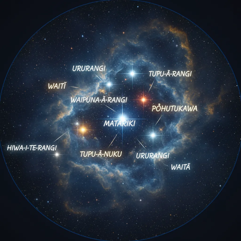
- Matariki: The mother star, signifying reflection, hope, and the connection to the environment.
- Pōhutukawa: Connects to those who have passed on.
- Waitī: Ties to bodies of fresh water and the food within them.
- Waitā: Ties to the ocean and salt water foods.
- Waipuna-ā-rangi: Associated with the rain.
- Tupu-ā-nuku: Associated with food that grows in the ground.
- Tupu-ā-rangi: Associated with food that comes from the sky (birds, fruit).
- Ururangi: Associated with the winds.
- Hiwa-i-te-rangi: The wishing star, associated with granting our desires for the coming year.
Using an interactive tool to identify Hiwa-i-te-rangi allows you to focus your aspirations precisely on the “wishing star,” adding a layer of spiritual intent to your technological observation.
Conclusion
The integration of an interactive night sky map tool into your Matariki celebrations does not detract from the tradition; rather, it makes the celestial knowledge accessible to a new generation. By utilizing features like AR visualization, light pollution overlays, and cultural toggles, you ensure that your viewing of the Māori New Year is accurate, educational, and profoundly meaningful. Download a reputable tool, bundle up warm, and head out before dawn to witness the rise of Matariki with confidence.
What is the best free app to find Matariki?
Stellarium Mobile is widely considered one of the best free options. It is open-source, highly accurate, and offers excellent sky culture settings that can be configured to display Māori star names and constellations.
Do night sky map tools work without the internet?
Yes, most high-quality sky map tools utilize the internal GPS and compass sensors of your phone, which do not require data. However, you must download the app and any necessary databases (offline mode) while connected to Wi-Fi before heading to remote locations.
How do I calibrate my phone for accurate star tracking?
To calibrate your phone’s compass, move the device in a figure-eight motion in the air a few times. Ensure you are away from large magnetic interferences like heavy machinery, large speakers, or high-voltage power lines, which can throw off the magnetometer.
Can I see Matariki with the naked eye?
Yes, Matariki is visible to the naked eye, appearing as a fuzzy cluster of stars. However, in light-polluted areas, you may only see 5 or 6 stars. Using binoculars or a telescope will reveal many more stars in the cluster.
Why does the map show Matariki in a different place than I see it?
This is usually due to compass interference or an incorrect location setting. Ensure your GPS permissions are enabled for the app. Also, check that the app’s time settings are set to “Current Time” rather than a future or past date.
What is the difference between Matariki and the Pleiades?
Astronomically, they are the same star cluster (Messier 45). The difference lies in the cultural narrative. The Pleiades refers to the Greek mythology of the Seven Sisters, while Matariki refers to the Māori narrative involving the mother star and her children, signifying the New Year.