A Puanga star map is a specialized astronomical chart designed to locate the star Rigel (Puanga) within the constellation Orion, specifically calibrated for the Southern Hemisphere sky. These maps are essential for observers in New Zealand regions like Taranaki and Whanganui, where Puanga, rather than Matariki, signals the Māori New Year due to local topography.
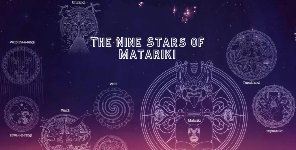
For astronomers, cultural educators, and stargazers in Aotearoa New Zealand, possessing an accurate Puanga star map is more than just a navigational necessity—it is a gateway to understanding regional Māori history and the celestial cycles that govern the environment. While the Matariki cluster (Pleiades) receives widespread attention, the star Puanga (Rigel) holds primary significance for iwi (tribes) on the West Coast and in the Far North. This guide explores the best high-resolution charts, digital apps, and physical resources available for tracking this brilliant blue supergiant.
What is Puanga and Why Do You Need a Specific Map?
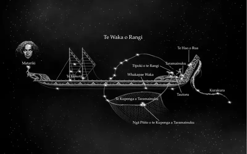
To effectively utilize a star map in New Zealand during the winter months, one must understand the celestial mechanics of Puanga. Puanga is the Māori name for Rigel, the seventh brightest star in the night sky and the brightest star in the constellation Orion (often referred to as Tautoru, or “The Three,” in reference to the belt).
Standard star charts produced for the Northern Hemisphere are virtually useless for this purpose. They display the sky inverted compared to the view from New Zealand. Furthermore, generic Southern Hemisphere maps may not highlight the specific heliacal rising (the first appearance before sunrise) that marks the New Year. A dedicated Puanga star map focuses on the eastern horizon in the pre-dawn hours of June and July, helping observers distinguish Rigel from the nearby Sirius (Takurua) and the belt of Orion.
High-Resolution Star Charts for New Zealand Skies
When sourcing commercial or educational star charts, resolution and projection accuracy are paramount. A high-resolution chart allows the user to identify not just the primary navigation stars, but the fainter surrounding constellations that serve as “pointers.”
Key Features of Quality Charts
Premium star charts for the New Zealand market should include:
- Magnitude Fidelity: The ability to clearly distinguish between Magnitude 0 stars (like Puanga) and Magnitude 2 stars (like the belt stars).
- Horizon Calibration: Charts must be calibrated for 35° to 47° South latitude. A chart designed for the equator will distort the position of Puanga relative to the horizon.
- Māori Nomenclature: High-value charts include dual naming conventions, listing both the IAU designation (Rigel) and the Te Reo Māori name (Puanga), along with other relevant stars like Atutahi (Canopus).
Detailed charts are often available through local observatories, such as the Stardome Observatory in Auckland or the Carter Observatory in Wellington. These institutions often produce annual almanacs containing month-by-month high-resolution sky maps.
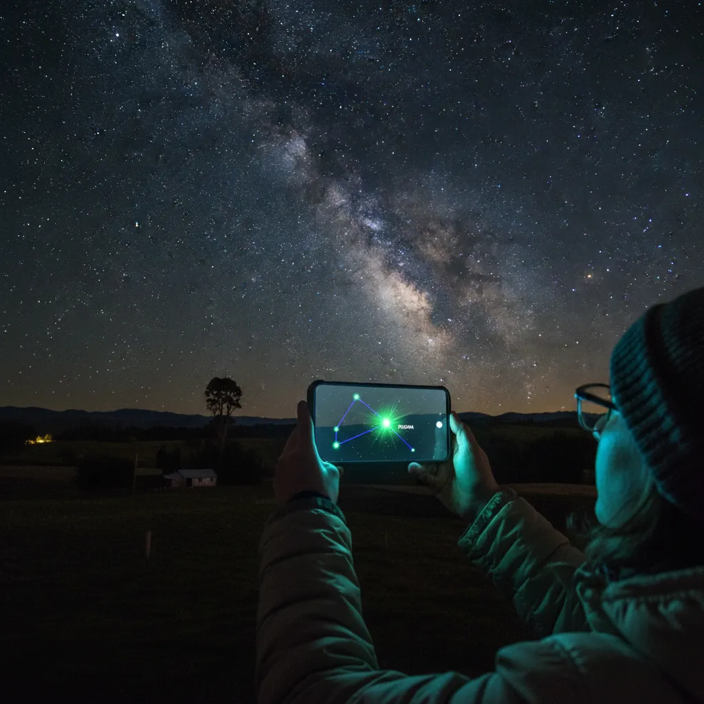
Apps for Tracking Puanga: Digital Star Maps
In the modern era, the most accessible “map” is often in your pocket. Augmented Reality (AR) astronomy apps have revolutionized how we locate Puanga. However, not all apps are created equal for the Southern skies.
Top Recommended Apps
Stellarium Mobile: This is the gold standard for serious stargazers. It allows you to simulate the sky from any location and time. You can fast-forward to a June morning to plan your viewing session. Its “sensor mode” allows you to hold your phone up to the sky to identify Puanga instantly.
Star Walk 2: A visually stunning app that is excellent for educational tourism. It overlays artistic representations of constellations. While usually Greek-centric, settings can often be adjusted to show the sky accurately from New Zealand coordinates.Sky Guide: Known for its ease of use, this app functions without a data signal, making it perfect for remote viewing locations in National Parks where Puanga is most visible.
Printable PDFs for Classroom and Field Use
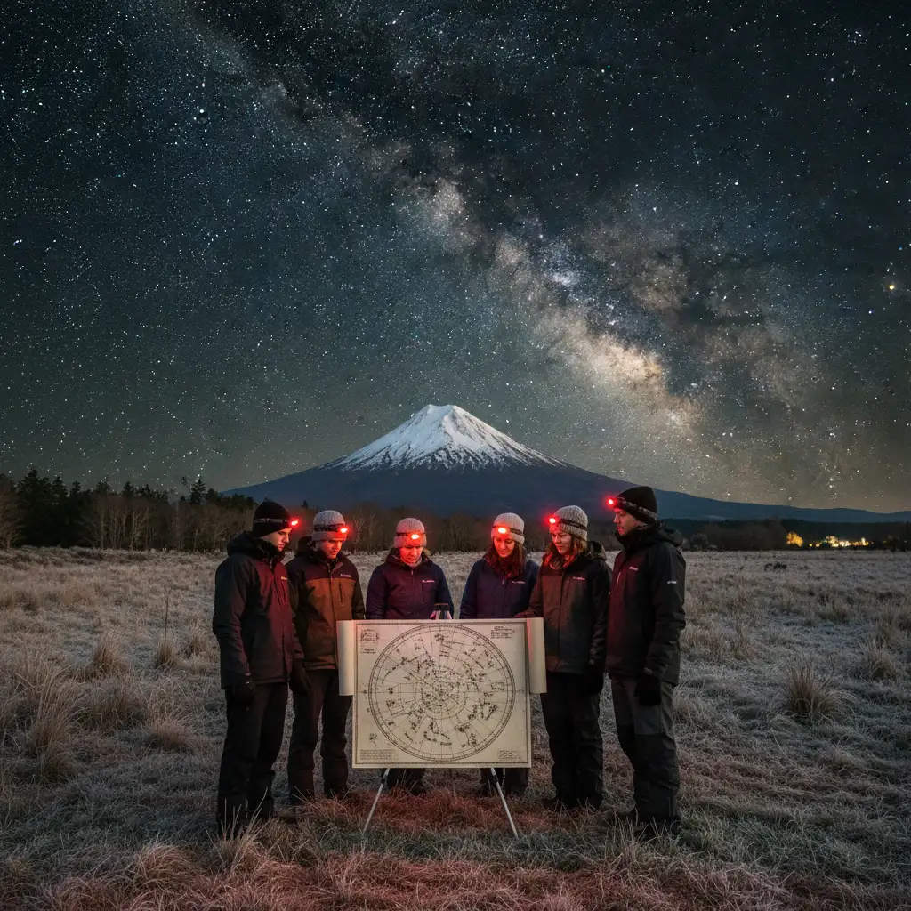
For educators and tour operators, digital screens can ruin night vision (scotopic adaptation). Red-light readable, printable PDF maps are the preferred commercial standard for field trips.
Where to Source Printables
Several educational bodies in New Zealand provide high-quality, printable resources specifically for Puanga and Matariki:
- Te Papa Tongarewa: The Museum of New Zealand frequently releases activity books and star charts that are free to download and print. These are vector-based, meaning they can be printed at large poster sizes (A1 or A0) for classroom walls without losing clarity.
- The Royal Astronomical Society of New Zealand (RASNZ): They publish monthly “Evening Sky” charts. While these are usually focused on the evening, their special editions for the Māori New Year cover the pre-dawn sky.
When printing these maps for field use, it is recommended to print on waterproof synthetic paper or heavy cardstock to withstand the dew and dampness typical of New Zealand winter mornings.
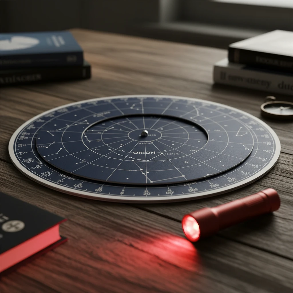
Buying Laminated Star Guides and Planispheres
For a durable, commercial-grade solution, a planisphere (a rotating star wheel) is an indispensable tool. Unlike a static map, a planisphere can be adjusted for the exact date and time of observation.
Selecting the Right Planisphere
When purchasing a planisphere for viewing Puanga, ensure you select a “Southern Hemisphere” edition. A Northern Hemisphere planisphere is useless in New Zealand.
- The Philips’ Planisphere (Southern 35°S): This is widely regarded as the industry standard. It is made of durable plastic and is easy to read.
- KiwiMaps Sky Guide: A locally produced option that often includes specific references to New Zealand’s seasonal changes.
Where to Buy: These physical guides are typically sold at museum gift shops, telescope specialty stores (like Jacobs Digital in Auckland), and major book retailers across New Zealand. Investing in a laminated guide ensures that your map survives the humid, frosty conditions of a Puanga viewing expedition.
Interpreting the Celestial Compass
Owning a map is one thing; reading it to interpret the celestial compass is another. The celestial compass is a method of navigation and timekeeping used by Polynesian voyagers, relying on the rising and setting points of stars.
How to Find Puanga Using a Map
- Orient East: Puanga rises in the eastern sky. Face the direction where the sun will eventually rise.
- Locate Tautoru (The Belt): Look for the three distinct stars in a vertical line (as seen from NZ). This is the belt of Orion.
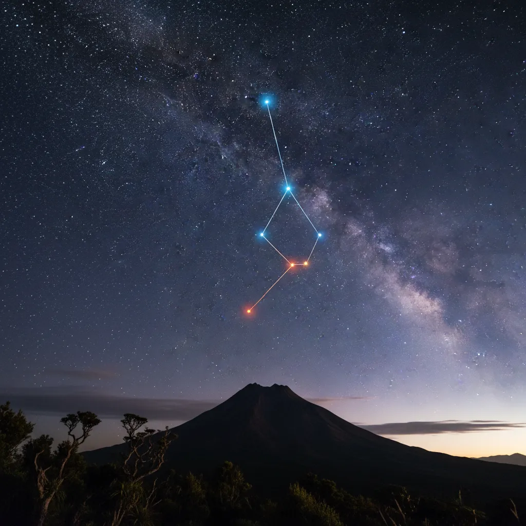
- Look Up: In the Southern Hemisphere, Puanga (Rigel) is located above the belt stars and slightly to the left. It is a blue-white supergiant, distinguishing it from the orange hue of Betelgeuse, which lies below the belt.
- Check the Anchor: Use your star map to verify the position relative to Sirius (the brightest star in the sky), which will be higher and to the right of Orion.
Understanding this alignment is crucial for cultural education tourism. Guides must be able to point out these relationships without constantly referring to the chart, using the map only as a verification tool for guests.
Best Locations to Use Your Star Map
A star map is most effective in areas with low light pollution. New Zealand boasts several Dark Sky Sanctuaries where the visibility of Puanga is unparalleled.
Taranaki: As the region that primarily celebrates Puanga, the areas surrounding Mount Taranaki offer spectacular views. The mountain blocks the view of Matariki for many iwi here, making Puanga the herald of the New Year.
Stewart Island / Rakiura: As an International Dark Sky Sanctuary, this location offers a pristine backdrop for using high-end star charts. The lack of light pollution means that faint stars marked on high-resolution maps are actually visible to the naked eye.
Aoraki Mackenzie International Dark Sky Reserve: While further inland, this is the premier astrotourism destination. Commercial tours here provide guests with professional charts and guided telescope viewings.
Frequently Asked Questions
What is the difference between a Matariki map and a Puanga map?
While both maps cover the same patch of winter sky, a Puanga map highlights the star Rigel (in Orion) as the focal point. Matariki maps focus on the Pleiades star cluster. Culturally, different regions in New Zealand prioritize one over the other based on visibility.
Can I use a Northern Hemisphere star chart in New Zealand?
No. Northern Hemisphere charts show the sky inverted compared to the view from New Zealand. Constellations will appear upside down, and many southern stars will be missing entirely.
When is the best time to use a Puanga star map?
The best time is during the Māori New Year period, typically June and July. You should use the map in the early morning hours, roughly an hour before sunrise, looking toward the eastern horizon.
Where can I buy a laminated Southern Hemisphere star chart?
You can purchase them at New Zealand observatories (like Stardome), museum gift shops (Te Papa), or online through retailers like Jacobs Digital or the Royal Astronomical Society of NZ website.
Is there a free app for finding Puanga?
Yes, Stellarium Mobile has a free version that is highly accurate for New Zealand skies. Google Sky Map is another free alternative for Android users.
Why is Puanga significant to Taranaki and Whanganui iwi?
In these regions, the geography (such as high mountain ranges) often obscures the low-rising Matariki cluster. Therefore, the higher and brighter star Puanga became the primary signal for the New Year and the changing seasons.